Understanding Multi-Sensor Fusion
- Brian Freed

- Nov 18, 2024
- 4 min read
Updated: May 22, 2025
Understanding Multi-Sensor Fusion: How LiDAR, Thermal, and Optical Vision are Revolutionizing Airfield Safety
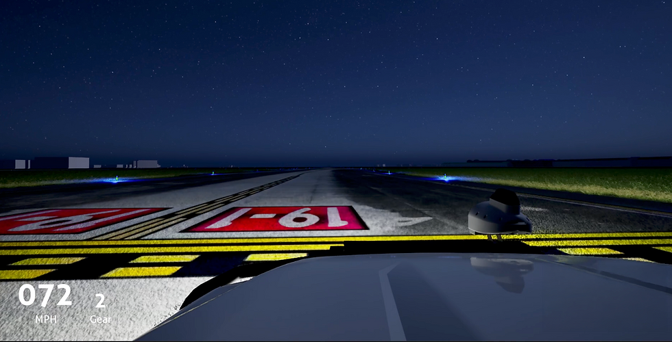
Imagine you’re trying to understand a scene with just your eyes. Now, add the ability to measure distances precisely and see heat. That’s what sensor fusion does, it gives a richer, more detailed understanding of the environment, much better than any single sensor or human perception alone. This is particularly true on the airfield where safety inspections play a critical role in ensuring smooth airport operations, preventing costly disruptions, and keeping passengers and staff safe. Traditionally these inspections have relied almost exclusively on human vision to assess runways, taxiways, and other key areas under diverse environmental and lighting conditions. But thanks to recent advancements in sensor technology, multi-sensor fusion has become a powerful alternative, bringing together different sensing technologies to provide a comprehensive view of airfield conditions that goes beyond what any single sensor could offer.
Here’s a closer look at how each of these sensors, LiDAR, thermal imaging, optical vision systems and GPS contribute to more precise and reliable airfield safety inspections:
LiDAR (Light Detection And Ranging)
Think of LiDAR as empowering inspectors to measure exact distances and create 3D maps, something our eyes can’t do. It’s like having a built-in rangefinder and 3D scanner. While a great golfer might be able to accurately judge the distance to the cup, even the best human judge of distance can’t match LiDAR’s accuracy for a single object, much less measure thousands of points simultaneously with millimeter accuracy.
LiDAR technology works by emitting laser pulses to map objects and surfaces in 3D. The laser bounces back to the sensor, allowing it to calculate the exact distance of objects in its path. This technology is incredibly useful for inspections that require accurate measurements such a pavement defects, ruts or depressions in the safety areas as well as providing enhanced performance in low-visibility scenarios, such as nighttime operations, rain, or fog, where traditional visual methods may fall short.
Precision in Surface Mapping: LiDAR excels at detecting minute surface irregularities. Even small debris or undulations in the pavement that might be challenging to detect with optical cameras alone can be identified by LiDAR.
Beyond Lighting Limitations: Since LiDAR is unaffected by light conditions, it offers consistent performance in both day and night settings. This makes it ideal for airfields where consistent monitoring and detailed mapping of runway conditions are crucial.
Optical Vision Systems
Visible light sensors are the most like the human eye and operate in the same visible light portion of the electromagnetic spectrum. Unlike our eyes, they don’t get tired and can capture more detail in a single frame. High-resolution visual cameras can be used in airfield inspections to provide detailed images that are especially useful in well-lit conditions. When integrated with AI, optical cameras can enable models to automatically detect anomalies and differentiate between various objects on the airfield. However, they can’t adapt to changing light conditions as quickly as the human eye and are susceptible to effects such as motion blur when the speed of a vehicle-mounted camera is increased.
Detailed Visual Identification: Optical cameras provide high-fidelity images of the airfield surface, allowing for clear identification of objects and surface details provided adequate lighting is available.
AI-Enhanced Analysis: By using AI to analyze optical data, these cameras can distinguish between benign objects and potentially hazardous objects such as FOD, creating an extra layer of accuracy and safety.
Thermal Imaging
Thermal Sensor are like having heat vision. They can see temperature differences that our eyes can’t, which is great for spotting things in the dark or identifying overheating equipment. Whether it’s humans, animals, or even inanimate objects, everything has a thermal signature that can reveal useful information for inspection and identification. Unlike visible light and LiDAR, there isn’t a comparative assessment; unaided by a thermal sensor, humans cannot perceive the thermal spectrum.
Thermal cameras capture infrared radiation emitted by objects, which translates into heat patterns. Unlike visible light cameras, thermal cameras visualize temperature differences, making them particularly valuable for detecting objects that don’t visually stand out but have distinct heat signatures.
Identification by heat signature: Thermal imaging can reveal objects that might be invisible under typical lighting, such as warm-blooded animals that stray onto the airfield. This ability to detect heat differences allows for a safer, more thorough inspection, especially at night. Not specific to the airfield, thermal imaging can also be used to detect anomalies in the heat signature of equipment, providing early indication of overheating bearings or wear points.
Complementing Visual Inspection: Thermal imaging can reveal subtle variations that other sensors might miss. By adding this “heat view” to the inspection process, airfield safety teams can access an additional layer of critical information.
Global Positioning System (GPS)
Given that the typical airside environment encompasses thousands of acres, GPS provides precise location data, ensuring that heatmaps, work orders, and remediation planning can rapidly and precisely identify and address the identified issue. This is crucial for mapping and tracking movements accurately
Why Multi-Sensor Fusion is Essential for Modern Airfield Inspections
Each of these sensing technologies provides unique and valuable information, but when used alone, each has significant limitations. For example, optical cameras might struggle in foggy or low-light conditions, and thermal cameras might miss objects with little to no heat signature. Multi-sensor fusion combines the strengths of each sensor type to create a more reliable, all-weather inspection system.
Improved Detection Accuracy: By merging data from multiple sensors, multi-sensor fusion systems can cross-validate anomalies, reducing the risk of false positives and ensuring critical issues are reliably flagged.
Environmental Adaptability: This approach allows airfield inspection systems to work effectively in a wide range of conditions—from foggy mornings to bright afternoons, providing a consistently accurate picture of runway and taxiway conditions.
Looking Ahead: The Future of Airfield Safety will be Multi-Sensor Fusion
As airfields continue to handle increased traffic and more demanding safety requirements, multi-sensor fusion is set to become a cornerstone of modern airport operations. By combining LiDAR, thermal imaging, optical cameras and GPS, airfields can not only streamline inspection processes but also move toward predictive maintenance. With further advancements, it’s likely we’ll see even more refined sensor integration, potentially incorporating new technologies like hyperspectral imaging for even greater depth and accuracy.
Ultimately, multi-sensor fusion is about making airfields safer, more efficient, and better equipped to handle the challenges of modern aviation. With its blend of precision, adaptability, and enhanced data analysis, this technology represents a significant leap forward for airfield safety inspections.